
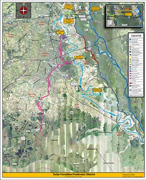
Fresh Water Supply for the Teche-Vermilion Basins
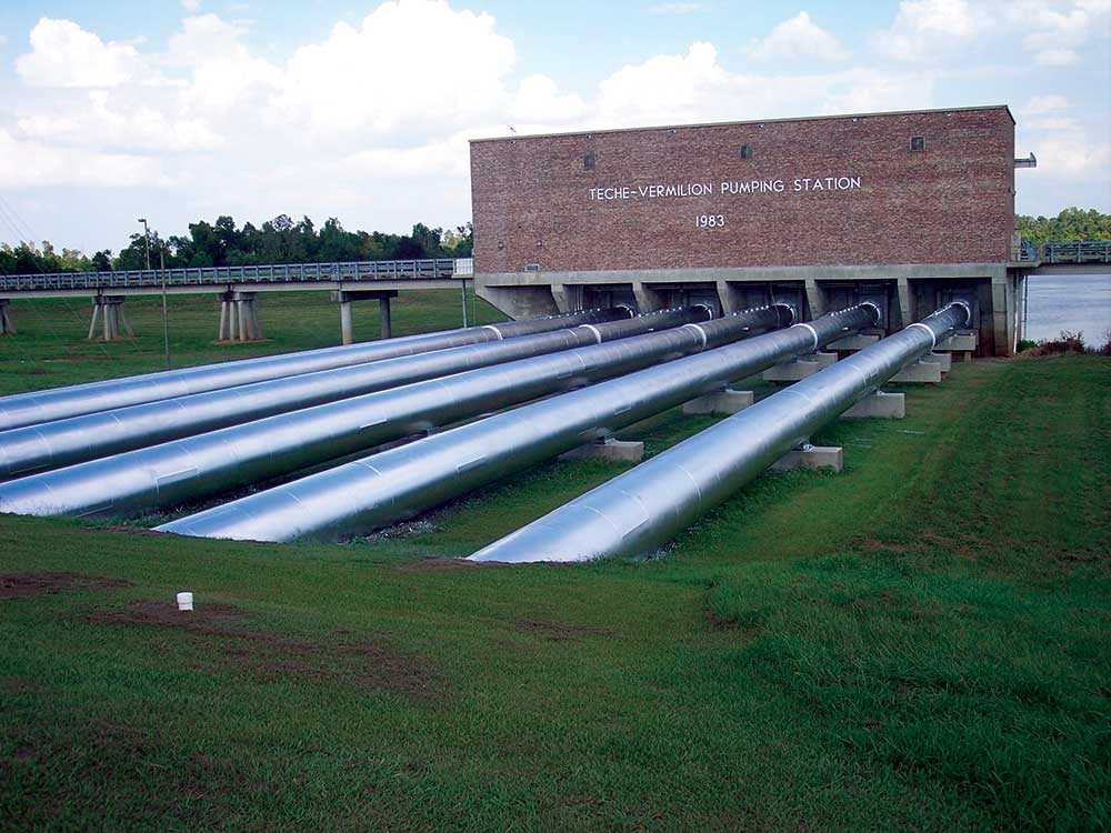
 Located about two miles upstream of Krotz Springs, Louisiana, on the Atchafalaya River, the pumping station has the capacity to divert 1,040 cubic feet per second of fresh water from the Atchafalaya River into Bayou Courtableau, which discharges into Bayou Teche and the channel formed by the borrow pit of the West Atchafalaya Basin Protection Levee. The project restored the historical connection between the Atchafalaya River and Bayou Courtableau.
The water is pumped from the Atchafalaya River into a six-mile long leveed conveyance channel, which carries the flow across the western side of the Atchafalaya Basin Floodway to the west protection levee. Within the floodway, several structures were constructed to accomplish passage of the flows. One is an inverted siphon (12×12-foot cross section), which carries the water under the State Canal. At U.S. Highway 71, the State of Louisiana constructed a bridge over the conveyance channel.
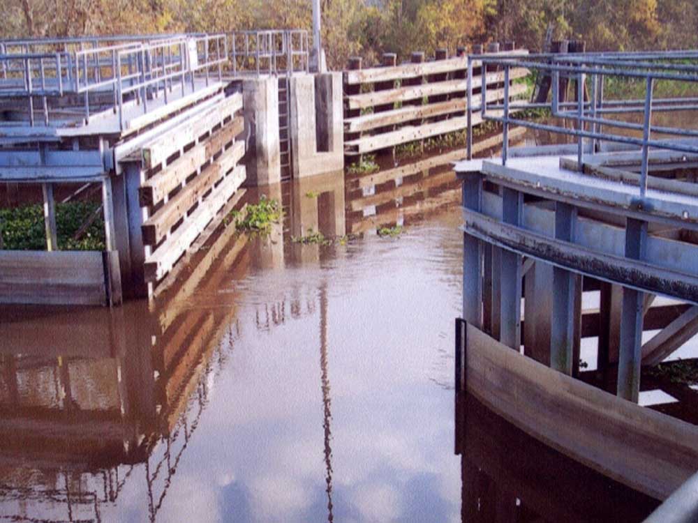
Where the channel meets the West Atchafalaya Basin Protection Levee, a gated control structure with two 10×10-foot openings passes the water through the levee into Bayou Courtableau. From Bayou Courtableau, the additional fresh water supply from the Atchafalaya River is distributed to various points downstream.
Most of the flows pass naturally into Bayou Teche. A small amount will at times pass through a gated control structure (a 54-inch gated pipe culvert) into the West Atchafalaya Basin Protection Levee borrow pit to flush out that channel when flows in Bayou Courtableau are too low to permit passage of water over the Bayou Courtableau weirs. Construction of the weirs predates the Teche-Vermilion Project. Flow in the borrow pit continues on to Bayou Amy, Catahoula Lake, Lake Dauterive, Lake Fausse Pointe and eventually to the Gulf of Mexico.
The fresh water flowing into Bayou Teche is shared with the Vermilion River at two points. The upstream diversion location is via Bayou Fuselier, where part of the additional flows are diverted through the Bayou Fuselier weir from Bayou Teche to Vermilion River. Further downstream, additional amounts of the flow is diverted to the Vermilion River via the Ruth Canal, originally constructed by local interests and obtained by the District as part of the Teche-Vermilion project.
 Below Ruth Canal, there is no further flow diversion. The only major feature of the Teche-Vermilion project constructed south of Ruth Canal is a sector-gated navigable control structure in the Loreauville Canal, which links Bayou Teche with Lake Fausse Pointe near New Iberia. The 56-foot wide structure prevents the additional fresh water from flowing into the lake and bypassing the lower reaches of Bayou Teche. The structure has a sill elevation of -9.8 feet to allow passage of navigation. As water flows through Bayou Teche, Bayou Amy and the Vermilion River, it reduces stagnation and pollution, benefits agriculture and protects our groundwater.
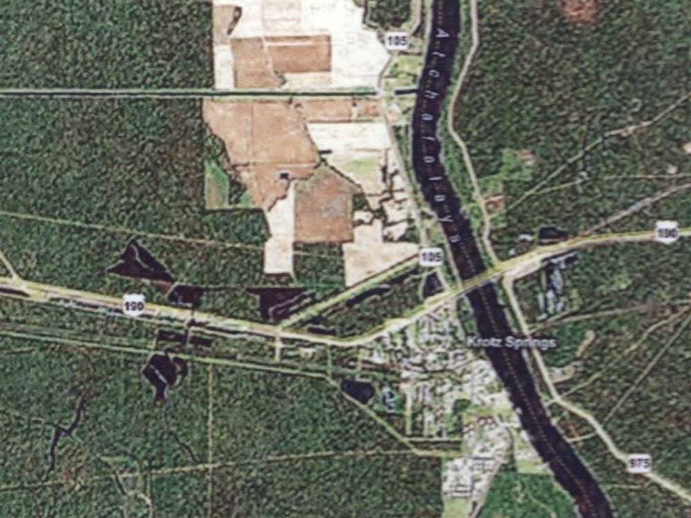 From the Atchafalaya River water is pumped into a six-mile long Conveyance Channel.
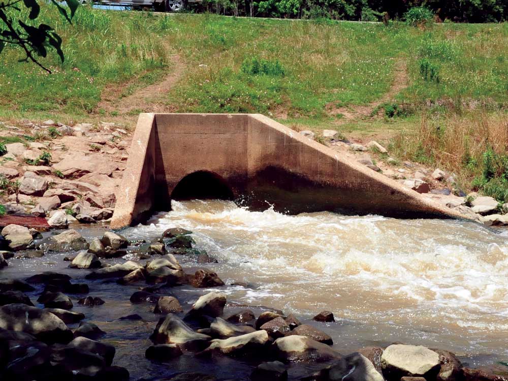 The Bayou Courtableau Borrow Pit Control Structure is operated to divert 10 percent of the pumped water into the WAFPL Borrow Pit south of Highway 190. This improves water quality in the Borrow Pit Canal, which flows into Bayou Amy and on into Catahoula Lake through Henderson.
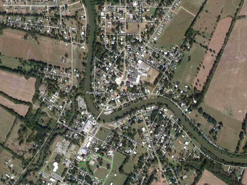 Once in Bayou Courtableau, water flows to Bayou Teche at its origin in Port Barre.
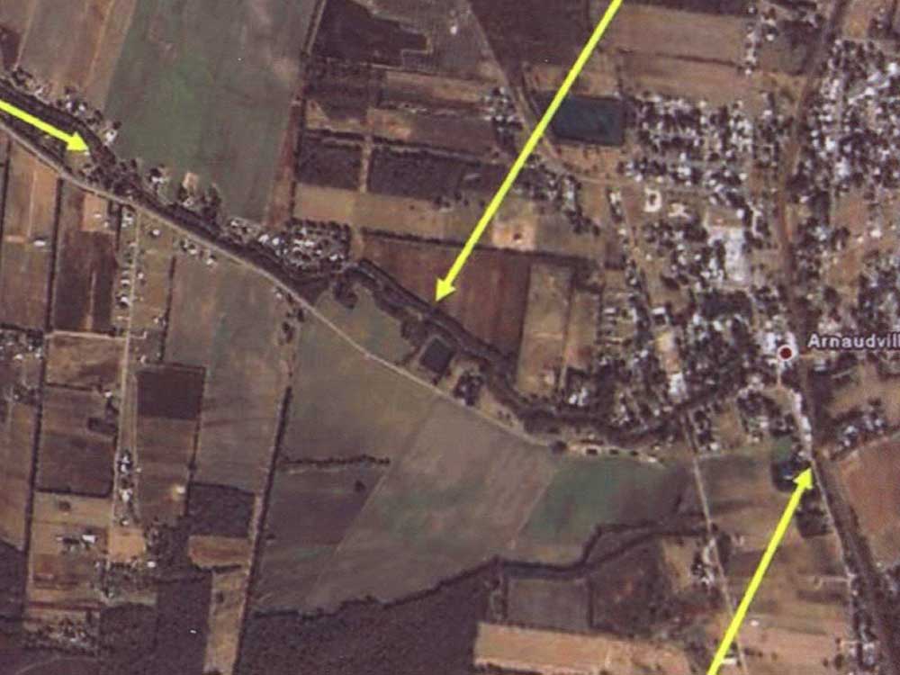 Water then flows south through Bayou Teche to the intersection with Bayou Fuselier in Arnaudville.
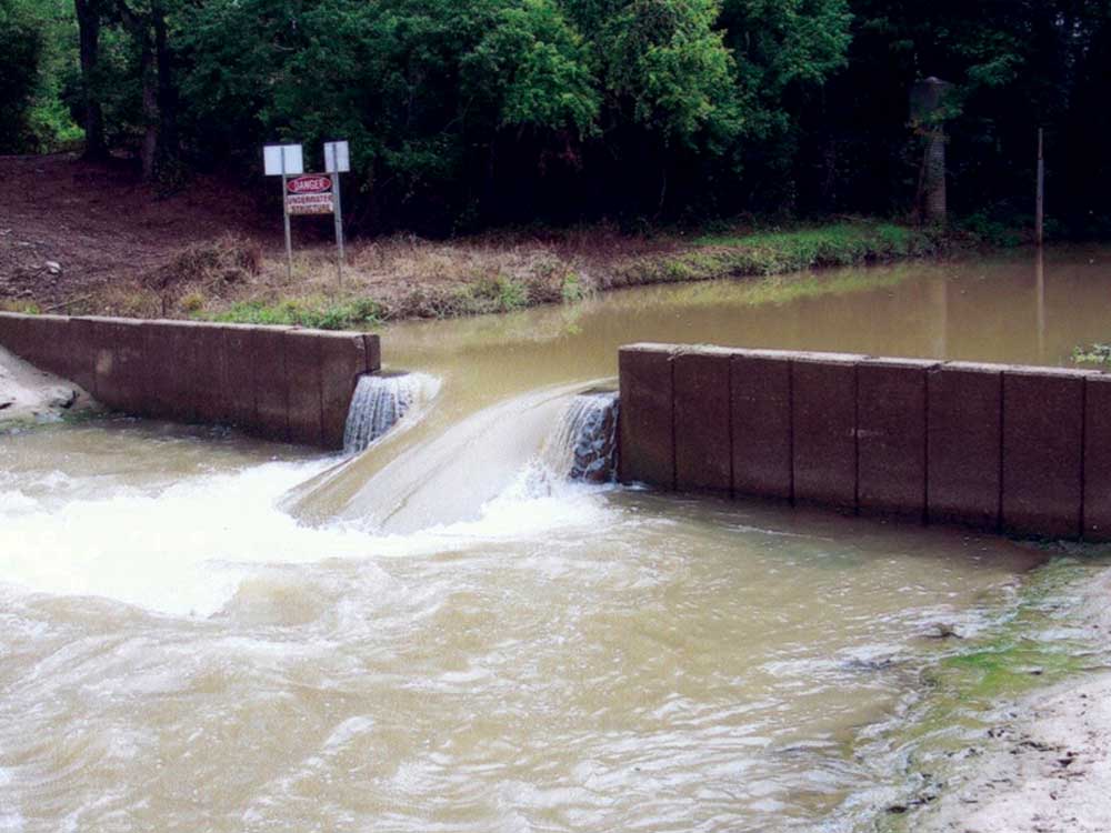 The Bayou Fuselier Weir limits the amount of flow into the Vermilion River, which forces most water further south in Bayou Teche.
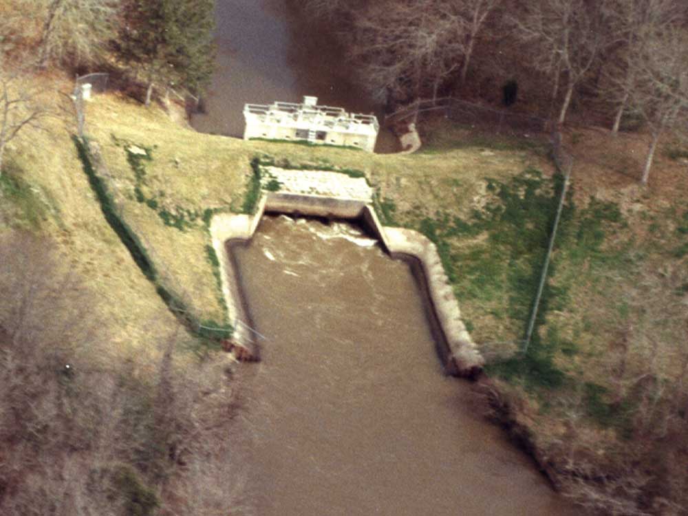 The Ruth Canal Structure regulates the division of flow between Bayou Teche and the Vermilion River. Once in the Vermilion River, water flows through Lafayette and Vermilion parishes.
Click on the map for a high resolution PDF.
CLICK THE BUTTON TO WATCH THE TVFWD VIDEO 
 The Loreauville Canal Control Structure prevents water from escaping into Lake Fausse Point, thus forcing fresh water downstream through Iberia Parish.